Pangaea
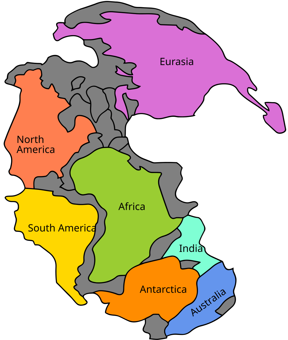

Pangaea was the global supercontinent which formed in the Palaeozoic era. The process started about 450 million years ago (mya) and was complete by 210 mya. So, apart from some volcanic islands (not proven, but very likely), all the land areas were collected together in one big supercontinent.
Pangaea was the latest of a series of global supercontinents. They formed at various times since plate tectonics began on Earth. Panthalassa was the name of the huge global ocean which surrounded Pangaea.
Formation
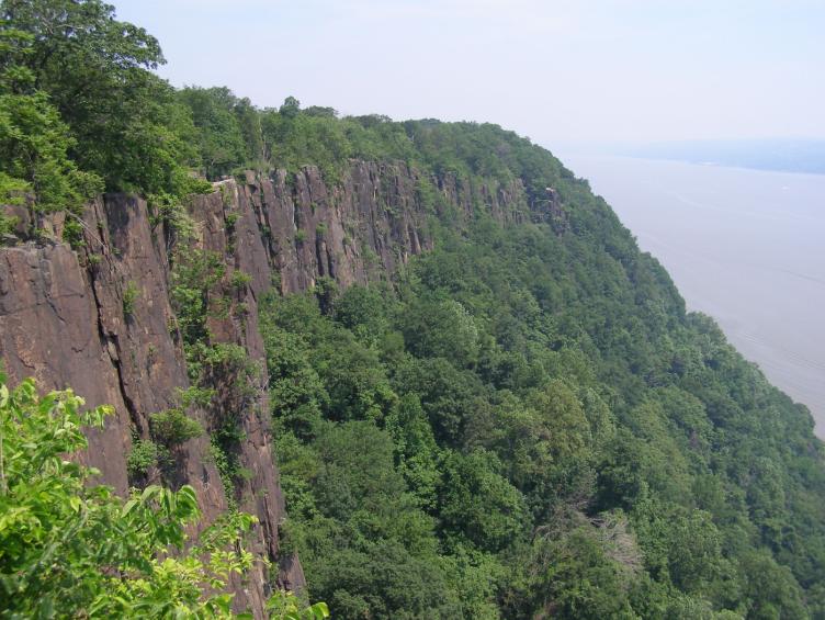
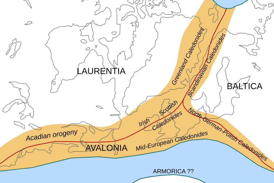
The collisions between continental plates formed the greatest mountain ranges in the history of the Phanerozoic eon. The mountain building included the Caledonian orogeny, the Alleghenian orogeny and the Variscan orogeny. The low mountains of Scotland, Scandinavia and eastern North America are the ground-down remains of these vast events.
Break-up
There were three major phases in the break-up of Pangaea. The first signs of rifting came in the Triassic before Pangaea was completely formed.
Pangaea broke up about 180/200 million years ago, in the early middle Jurassic. It broke into supercontinents Laurasia and Gondwana before each of these broke into the present continents. One rift resulted in a new ocean, the North Atlantic Ocean.
The second major phase in the break-up of Pangaea began in the Lower Cretaceous (150–140 mya), when Gondwana separated into continents (Africa, South America, India, Antarctica, and Australia).
The third major and final phase of the break-up of Pangaea occurred in the early Cenozoic (Paleocene to Oligocene). Laurasia split when North America (Laurentia) broke free from Eurasia, opening the Norwegian Sea about 60–55 mya. The Atlantic and Indian Oceans continued to expand, closing the Tethys Ocean.
The break-up of Pangaea continues today in the Great Rift Valley in East Africa and Arabia.
Other sources
- Matte P. 2001. The Variscan collage and orogeny (480-290 mya) and the tectonic definition of the Armorica microplate: a review. Terra Nova 13, 122-128.
- Stampfli G.M; Raumer J.F. von & Borel G.D. 2002. Paleozoic evolution of pre-Variscan terranes: from Gondwana to the Variscan collision. Geological Society of America Special Paper 364, pp. 263–280.
- Torsvik T.H. et al 1996. Continental break-up and collision in the Neoproterozoic and Palaeozoic - a tale of Baltica and Laurentia. Earth-Science Reviews 40, pp. 229–258.
- Ziegler P.A. 1990. Geological atlas of western and central Europe. 2nd ed, Shell Internationale Petroleum Maatschappij B.V.
Written for younger readers
Pangaea, in simpler words
This version comes from Wikijunior, a set of books written for children aged 8 to 11. It is shorter and uses plainer language than the article above.
From Wikijunior: Dinosaurs
Pangaea was a big super-continent of Earth. A super-continent means a very large area of land made up of several continents we know today. Pangea formed during the Mesozoic era three hundred million years ago. Nearly all the countries we have today were part of Pangaea. Many mountains today were made in this supercontinent. Pangaea was surrounded by one big ocean called Panthalassa.
Pangaea broke up during the Jurassic period 180 million years ago and it split into two continents: Gondwana in the South and Laurasia in the North. After this they split again into the continents we have today.
Scientists think that there were two super-continents before Pangea, one called Rodinia which was made 1,100 million years ago, then split 750 million years ago and one called Pannotia which was made 600 million years ago, then split 540 million years ago.
The Tethys Ocean has been around for millions of years; it probably was around when these super continents existed. During the Triassic period, the Tethys Ocean was located to the east of Pangaea and Laurasia. During the Jurassic, when the supercontinent split into Gondwanaland and Laurasia, the south-eastern opening to the Tethys Ocean became tighter, thus making the Tethys Ocean more contained. During the Cretaceous, Gondwanaland split into the continents of Africa, Australia and India. India was drifting through the Tethys Ocean; but now the Tethys Ocean is probably part of the Indian Ocean. Laurasia wasn’t always part of the two Jurassic cotinents; it was also part of Pangaea. Laurasia was the northern part of Pangea. Laurasia stayed Laurasia for millions of years while Pangea split and shaped into a different continent called Gondwanaland.
Where this page comes from
The article above is adapted from “Pangaea” on Simple English Wikipedia, by its contributors. We removed reference markers, navigation boxes and tables, expanded measurement templates into readable numbers, and kept the prose otherwise intact. The simpler version is adapted from Wikijunior on Wikibooks.
Both sources are published under CC BY-SA 4.0, so this page is published under the same licence. You may share and adapt it, including commercially, as long as you credit the original and keep the same licence.
Worksheets, answer keys and printable layouts elsewhere on K5Print are our own work and are not covered by this licence.