Connecticut

Quick facts
- Largest city
- Bridgeport
- Abbreviation
- CT
- Became a state
- January 9, 1788 (the 5th state)
- Area
- 5,543 sq mi (14,356 km²)
- Population (2020)
- 3,688,496
Facts from Wikipedia’s “Connecticut” page (CC BY-SA 4.0).
Connecticut is a state in the United States. Its capital is Hartford, and its largest city is Bridgeport. It is one of the six states of New England. It borders New York to the west, Massachusetts to the north, Rhode Island to the east, and the Long Island Sound to the south.
Connecticut is called the “Constitution State.” In 1639 settlers adopted the “Fundamental Orders,” which has been called the first written constitution in history. Its current constitution (Connecticut’s third) was adopted in 1965.
Geography
Connecticut has forests, rivers, lakes, waterfalls, and a sandy shore.
The Connecticut River cuts through the center of the state. It flows into Long Island Sound, Connecticut’s outlet (connection) to the Atlantic Ocean.
Regional variations
Even though Connecticut is small, different parts of the state have different landscapes and culture.
Some areas are very rural. For example, the Litchfield Hills in northwestern Connecticut have rolling mountains and horse farms. There are many small towns and rural areas in the northeast and northwest corners of the state.
Connecticut also has industrial cities, located along the coastal highways from the New York border to New Haven, then northwards to Hartford, and farther up the coast near New London.
The state has some very wealthy areas. The southwestern corner of Connecticut, where it touches New York State, includes Greenwich, Stamford, Fairfield, Westport, Wilton, and Darien. Some of the wealthiest residents in the world live in these areas.
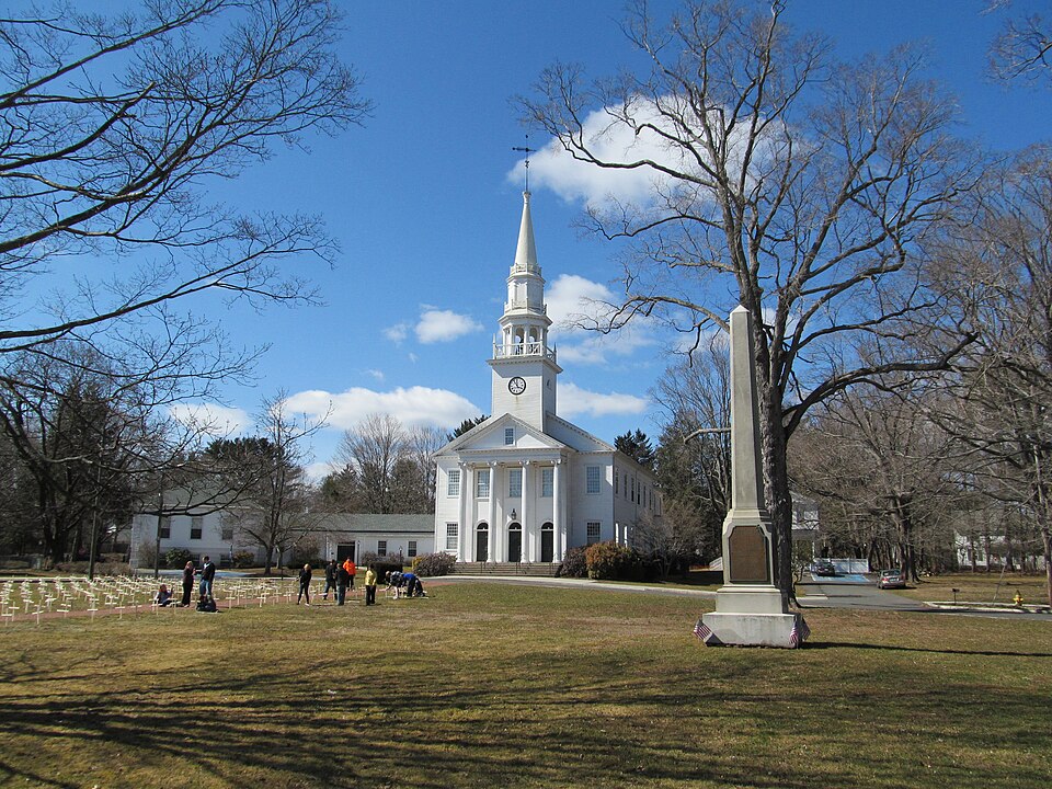
Many towns center around a small park, known as a “green” (such as the New Haven Green). Near the green there is often a small white church, a town meeting hall, a tavern, and several colonial houses.
Highest locations
The highest peak in Connecticut is Bear Mountain in Salisbury, in the northwest corner of the state.
The highest point is just east of where Connecticut, Massachusetts, and New York State meet (42° 3’ N; 73° 29’ W), on the southern slope of Mount Frissell, whose peak lies nearby in Massachusetts.
National Parks
The United States National Park Service maintains several areas in Connecticut. These include the:
- Appalachian National Scenic Trail
- Quinebaug & Shetucket Rivers Valley National Heritage Corridor
- Weir Farm National Historic Site
The Appalachian Trail
The Appalachian Trail runs for about 52 miles through Connecticut, passing through hardwood forests.
At its lowest, the Trail in Connecticut is 260 feet above sea level (just under 80 meters). At its highest, its is nearly half a mile high (2316 feet, or 796 meters).
History
The name “Connecticut” comes from the Mohegan Indian word Quinnehtukqut. This word means Long River Place or Beside the Long Tidal River.
Colonial history
In 1614, a Dutch man named Adriaen Block became the first European explorer to arrive in modern-day Connecticut. After that, Dutch fur traders sailed up the Connecticut River (which they called Versche Rivier). They built a fort near present-day Hartford, which they called House of Hope (Huys de Hoop in Dutch).
The first English settlers arrived in 1633. They were Puritans from Massachusetts, led by the Reverend Thomas Hooker. They founded the Connecticut Colony.
Colonies were also established at Old Saybrook and New Haven, which later became part of Connecticut. Historically important colonial settlements included:
- Windsor (1633)
- Wethersfield (1634)
- Saybrook (1635)
- Hartford (1636)
- New Haven (1638)
- New London (1646)
Because the Dutch were outnumbered by the English settlers, they left their fort in 1654.
Connecticut is the fifth of the original thirteen states.
Changing borders
Connecticut’s western borders have changed over time.
According to a 1650 agreement with the Dutch, the western boundary of Connecticut ran north from the west side of Greenwich Bay (“provided the said line come not within 10 miles [16 km] of Hudson River”).
On the other hand, Connecticut’s original Charter in 1662 granted it all the land to the “South Sea” (the Pacific Ocean, which is on the West Coast of the United States).
Connecticut got its current boundaries because:
Government officials made agreements with New York
Connecticut fought for control of Westmoreland County during the Pennamite Wars against Pennsylvania
Congress got involved in setting borders after the Pennamite Wars
Connecticut had to give up and sell the Western Reserve lands
Written for younger readers
Connecticut, in simpler words
This version comes from Wikijunior, a set of books written for children aged 8 to 11. It is shorter and uses plainer language than the article above.
From Wikijunior: North America
Connecticut is a state located in the New England region of the northeastern United States of America. The state borders New York to the west and south, Massachusetts to the north, and Rhode Island to the east. Portions of southwestern Connecticut are considered part of the New York metropolitan area. Connecticut is the 29th most populous state with 3.4 million residents and ranked 48th in size by area. The state capital is Hartford and its largest city is Bridgeport. Other big cities in Connecticut include Stamford and New Haven.
The Mohegan tribe lived in the Connecticut region before the Europeans arrived. The first European explorer in Connecticut was the Dutch explorer Adriaen Block. After he explored this region in 1614, Dutch fur traders sailed up the Connecticut River and built a fort at Dutch Point near present-day Hartford, which they called “House of Hope”.
John Winthrop, then of Massachusetts, received permission to create a new colony at Old Saybrook at the mouth of the Connecticut River in 1635. This was the first of three distinct colonies that later would be combined to make up Connecticut.
The first English settlers came in 1633 and settled at Windsor and then Wethersfield in 1634. However, the main body of settlers came in one large group in 1636. The settlers were Puritans from Massachusetts, led by Thomas Hooker. Hooker and his followers established the Connecticut Colony at Hartford in 1636. This was the second of the three colonies.
The third colony was founded in March 1638. New Haven Colony was established by John Davenport, Theophilus Eaton and others at New Haven.
Connecticut is bordered on the south by Long Island Sound, on the west by New York State, on the north by Massachusetts, and on the east by Rhode Island. The capital is Hartford and the largest city is Bridgeport.
Summer is hot and humid throughout the state. Fall months are mild, and bring colorful foliage across the state in October and November. During hurricane season, tropical cyclones occasionally affect the region. Thunderstorms are most frequent during the summer, occurring on average 30 times yearly. These storms can be severe, though tornadoes are rare.
Connecticut’s highest point is Bear Mountain. It is 2,316 feet above sea level.
In 2020, the United States Census Bureau estimated the population of Connecticut was 3,605,944.
In 2010, 77.6% of people in Connecticut were White/Caucasian, 10.1% were Black, 3.8% were Asian, and 0.3% were Native American.
- The state’s official nickname is The Constitution State. Other unofficial nicknames include The Nutmeg State, The Provisions State, and The Land of Steady Habits
- The state motto is “Qui transtulit sustinet”. It is Latin for “He who transplanted still sustains”.
- The state aircraft is the F4U Corsair
- The state animal is the sperm whale
- The state bird is the American robin
- The state cantana is “The Nutmeg”
- The children’s state flower is Michaela Petit’s Four-O’ Clocks
- The state composer is Charles Ives
- The state dinosaur is Dilophosaurus
- The state fish is the American shad
- The state flagship and tall ship ambassador is the Freedom Schooner Amistad
- The state flower is the mountain laurel
- The state folk dance is the square dance
- The state fossil is Eubrontes giganteus
- The state hero is Nathan Hale
- The state heroine is Prudence Crandall
- The state insect is the European mantis, or praying mantis
- The state mineral is garnet
- The state poet laureate is Margaret Gibson
- The state polka is the ballroom polka
- The state shellfish is the eastern oyster
- The state ship is the USS Nautilus
- The state songs are Yankee Doodle and Beautiful Connecticut Waltz
- The state tree is the Charter Oak
- The state troubadour is the Connecticut State Troubador
Where this page comes from
The article above is adapted from “Connecticut” on Simple English Wikipedia, by its contributors. We removed reference markers, navigation boxes and tables, expanded measurement templates into readable numbers, and kept the prose otherwise intact. The simpler version is adapted from Wikijunior on Wikibooks.
Both sources are published under CC BY-SA 4.0, so this page is published under the same licence. You may share and adapt it, including commercially, as long as you credit the original and keep the same licence.
Worksheets, answer keys and printable layouts elsewhere on K5Print are our own work and are not covered by this licence.