Hungary

Fast facts
- Capital
- Budapest
- Languages
- Hungarian
- Currency
- Hungarian forint
- Time zone
- CET
- Drives on
- right
- Calling code
- +36
Facts from Wikipedia’s “Hungary” page (CC BY-SA 4.0).
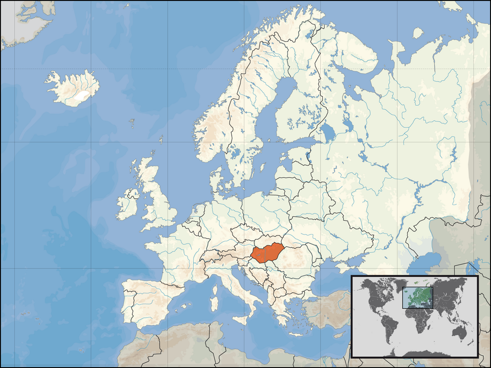
Hungary ( ) is a landlocked country in southeastern Central Europe. It is bordered by Slovakia to the north, Ukraine to the northeast, Romania to the east and southeast, Serbia to the south, Croatia and Slovenia to the southwest, and Austria to the west. Hungary lies within the drainage basin of the Danube River and is dominated by great lowland plains. It has a population of 9.6 million. Hungarian is the official language, and is among the few in Europe outside the Indo-European family. Budapest is the country’s capital and largest city, and the dominant cultural and economic centre.
Medieval Hungary, 896-1526
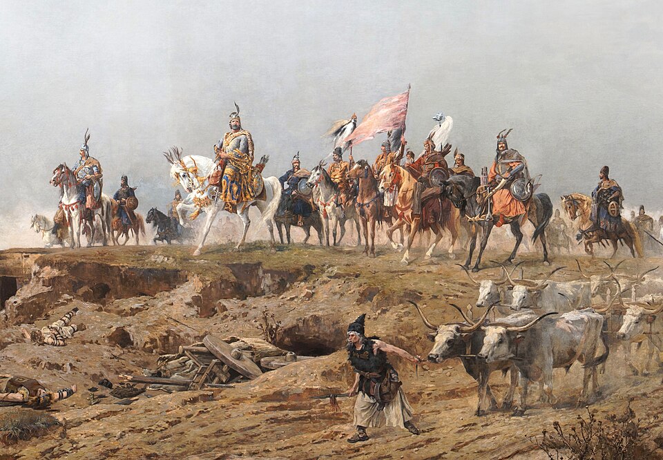
The Magyars established Hungary in 896, after they had arrived there from their previous, Eastern European territories. Prince Árpád was their leader at the time; he also established the first royal house of the country, the Árpád-house. In 1000, after the first king, Saint Stephen had been crowned, the country became a Kingdom.
In 1241, the Mongol Empire invaded the country, causing the Hungarian king Béla IV to flee and approximately 500,000 Hungarians were killed, along with heavy damage. In 1301, the Árpád-house died out. Later on, kings from various houses ruled over Hungary. The greatest of them is Matthias Corvinus, famous for taking Austrian terrirories like Vienna, etc. and protecting the country against Ottoman aggression. However, some decades after he had died (1490), the Ottoman Sultan Suleiman the Magnificent defeated the Hungarian king in the Battle of Mohács (1526). The Kingdom was cut up into three parts: the western and northern areas remained Hungary, the southern region fell under Ottoman rule, and the eastern part became an Ottoman vassal as the Principality of Transylvania.
Between 1526 and 1867
The Kingdom of Hungary became a Habsburg dependency, because an agreement made in Vienna in 1515 said that the Habsburg family would take over the territory of the Jagellion family in Bohemia and Hungary if the line of kings should die out. In 1686, the Ottomans were forced to leave, and the country was reunified. Many nationalities were living in the country at this time. Along with Hungarians, there were also the ancestors of modern Slovaks, Serbs, Romanians and Germans (known as Danube Swabians).
In 1703, Francis II Rákóczi, a Hungarian nobleman, organized a revolution against the Habsburgs, as the Hungarians were not satisfied with them. However, his revolution failed in 1711, and he had to go into exile. The next most important event is the “Hungarian Revolution of 1848”, when the inhabitants of the country mutinied again. Fighting ended in 1849, with Habsburg success. The leaders of the revolution were executed.
Austria-Hungary, 1867-1918
The country tried to find the way towards consolidation: in 1867, the two most important Habsburg territories, Austria and Hungary signed a treaty, and they established the Austro-Hungarian Monarchy. The new situation was feasible for both sides: the agreement brought massive economic growth.
Between 1918 and 1946
In 1918 after the defeat in World War I, the Kingdom was abolished, and a republic was established, as people had enough of war. This republic was short-lived, and soon the Communists seized power (1919). Their rule was irresponsible and many people, including the peasants and the intelligentsia, were tortured. The communists had to abandon the country as Romanian troops invaded.
In late 1919, the Hungarian forces, led by Admiral Miklós Horthy, finally occupied the capital, Budapest. In response to the communist terror, they launched the “White Terror”, in which they persecuted the communists and their supporters. The kingdom was re-established but there was no king. Horthy was elected as the regent of the country, as the assembly decided not to recall the Habsburgs.
Hungary lost the war. According to the Treaty of Trianon (1920), Hungary lost two thirds of its territory. In the majority of these territories, non-Hungarians were the majority; however, many Hungarians also found themselves outside their country, in the nation state of Romanians or Slovaks. Thus, the main political goal of the governments under Horthy was to revise this treaty, and at least, to regain the Hungarian-inhabited lands.
Communist Hungary, 1946-1989
After the fall of Nazi Germany, Soviet troops occupied all of the country. So Hungary gradually became a communist satellite state of the Soviet Union. After 1948, Communist leader Mátyás Rákosi established Stalinist rule in the country. He forced collectivization and a planned economy. This led to the 1956 Hungarian Revolution. Hungary withdrew from the Warsaw Pact. But the Soviets sent in over 150,000 troops and 2,500 tanks. Nearly a quarter of a million people left the country during the brief time that the borders were open in 1956. János Kádár became leader of the communist party. In 1991 Soviet military presence in Hungary ended, and the transition to a market economy began.
Republic of Hungary, 1989 onwards
Today, Hungary is a democratic republic. Elections are held every four years.
The current president of the country is Katalin Novák and the prime minister is Viktor Orbán. Orbán was Prime Minister from 1998 to 2002, and was elected again in 2010.
Demographics
Hungarians make up the largest part of the population but there are also several other ethnic communities. The largest of these are the Roma and Germans. Hungarian is the most widely used language in Hungary. Ethnic communities often use their own languages as well. The majority of Hungarians are religious, mainly Roman Catholic and Calvinist (in Hungarian ‘református’ - ‘reformed’). There are Jews, often in intellectual and artistic occupations, and some Muslims. Orthodox Christianity is practised by ethnic minorities from eastern Europe.
Geography
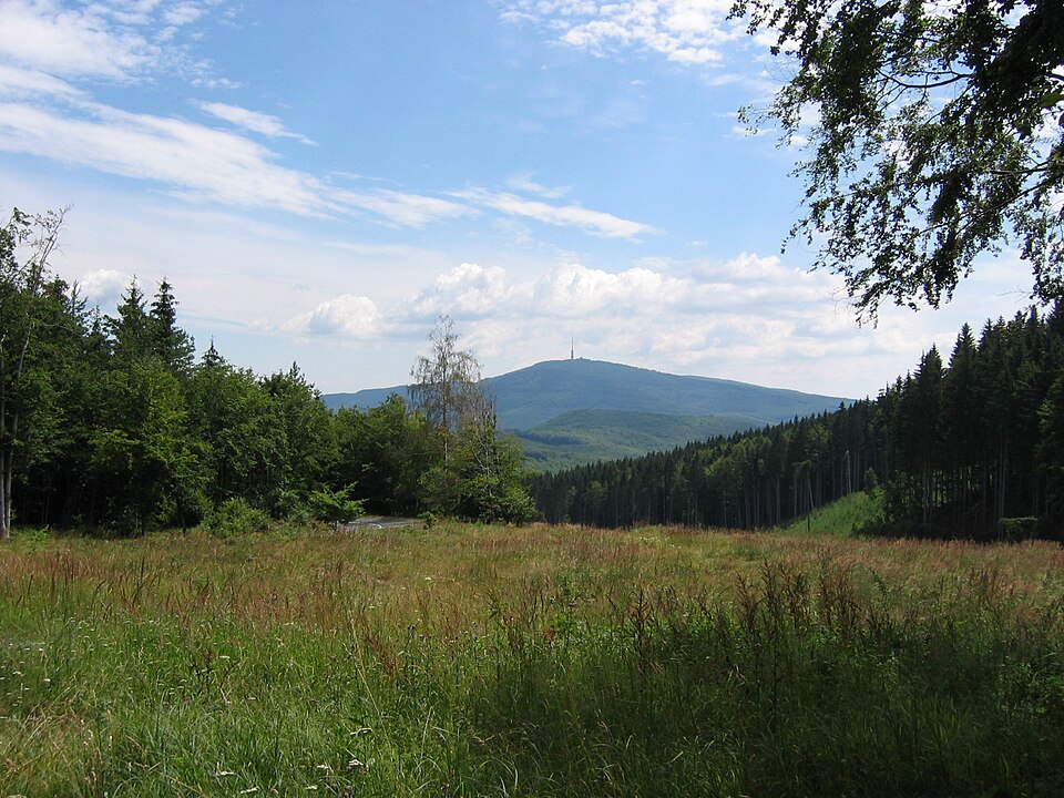
Hungary’s highest point is Kékestető (1014 m; in the northeastern part of Hungary). The River Danube, one of Europe’s largest rivers, divides Hungary into a western and an eastern part. The region west of the Danube is called Transdanubia (Dunántúl). Transdanubia has a hilly landscape and many small villages and towns. The large flat area in the eastern part is the Great Plains (Alföld). Along the Slovakian border there are mountains.
Lake Balaton, Central Europe’s largest lake can be found in Hungary. This small country has several thermal spas too. Lake Hévíz is one of the world’s largest thermal lakes. Hungary, however, is a landlocked country (it has no coastline).
Its biggest cities are Budapest, Debrecen, Miskolc, Szeged, Pécs, Győr, Nyíregyháza and Szolnok. Szolnok is found at the juncture of the Tisza River and the Zagyva River (stream).
Written for younger readers
Hungary, in simpler words
This version comes from Wikijunior, a set of books written for children aged 8 to 11. It is shorter and uses plainer language than the article above.
From Wikijunior: Europe
Hungary is a country in the south-eastern part of Central Europe. It shares borders with Slovakia, Ukraine, Romania, Serbia, Croatia, Slovenia and Austria. The capital city is Budapest. Other big cities in Hungary are Debrecen, Szeged and Miskolc. Hungary has been a member of the European Union since 2004 and uses the Forint as its currency.
Hungary was founded in 1000 by István I (Stephen) as a kingdom. Croatia became a part of Hungary in the 12th century. The Mongols attacked Hungary in the 13th century. In 1301 the last king from the Árpád dynasty died and after that the kings came from several families. In 1526 the Turks conquered large parts of the country, after that the country split up into three parts called Royal Hungary, Transylvania and Ottoman Hungary. The king of Royal Hungary came from the Habsburg family, so it became a part of the Austrian Empire. Hungary was re-united in 1699. After that there were two big uprisings against the Habsburg kings: one from 1703-1711 and the other in 1848-1849. The first one was lead by Francis II Rákóczi and Sándor Petőfi the poet took part in the second one. People in Hungary are proud of them, a lot of streets and schools have their names. After World War I the Allied powers divided Hungary and gave the parts to the neighboring countries. Almost 3.5 million Hungarians became minorities mostly in Romania, Slovakia and Serbia. In World War II joined the Axis powers and took back some of these territories, but after the war lost them and the Soviets took control. In 1956 there was a revolt against the Communist government. In 1989 Hungary became a republic.
Hungary can be found in the Carpathian basin. Most of Hungary is flat but the Carpathian mountains in the northern part of the country reach a height of 1,014m at the Kékes mountain. The country is land-locked.
Hungary has a population of about 10 million. Most of the population speaks Hungarian. Other spoken languages most common are English amongst the younger generation, and Russian amongst the older generation - though some refuse to use it due to the Communist connotations. Other languages include Slovakian, Romanian, Croatian, Ukrainian and German spoken in minority pockets at the relevant borders of those countries. Most of the Hungarian population are Christian (Catholic, Protestant and Orthodox). There are small numbers of Jews too.
The city of Budapest is a UNESCO World Heritage Sites.
There are many things to see in Hungary. Within Budapest, the Országház (Parliament Building) is one of the most spectacular and famous Houses of Parliament in Europe. Opposite the Országház, is the Imperial Palace, the place of residence for the past rulers of Hungary. Mainly used during the Austrian occupation, it is a reminder of the country’s turbulent history, along with Kossuth Tér, dedicated to the revolutionary Lajos Kossuth. Nearby is the everlasting flame - a fire that his been burning since the departure of the Communists in 1989. Also in the capital is the Basilica of St. István, the patron Saint of Hungary. Another highly recommended place to see is Hősök Tére (Heroes Square). It is a colonnade containing statues of all the kings of Hungary and in the centre is a column upon which St. István stands holding the Szent Korona (Saint’s Crown).
Outside of the capital is the famous Lake Balaton. A favourite among the native population and tourists alike, the lake offers unparalleled a great beach-side holiday in a land-locked country. It is 14km wide and 75km long and can be seen from space. Lake-side towns of Siofok and Balatonfüred are popular tourist accommodations. A main cultural attraction at the lake is the peninsula of Tihany, hosting a Medieval Abbey which used to be a religious centre hundreds of years ago. Today, it is the mausoleum of Károly IV, the last King of Hungary. Inside is an exhibition dedicated to life inside the Abbey and also one about the King.
The town of Győr is famous in Hungary for its confectionery. “Győri” products are a common item seen on Hungarian supermarket shelves. The town itself boasts an impressive town hall as well as bank side walks along the Danube.
Where this page comes from
The article above is adapted from “Hungary” on Simple English Wikipedia, by its contributors. We removed reference markers, navigation boxes and tables, expanded measurement templates into readable numbers, and kept the prose otherwise intact. The simpler version is adapted from Wikijunior on Wikibooks.
Both sources are published under CC BY-SA 4.0, so this page is published under the same licence. You may share and adapt it, including commercially, as long as you credit the original and keep the same licence.
Worksheets, answer keys and printable layouts elsewhere on K5Print are our own work and are not covered by this licence.