Nauru

Fast facts
- Capital
- Yaren (de facto) Officially none a
- Largest city
- Denigomodu
- Official language
- English * Nauruan
- Languages
- English
- Currency
- Australian dollar
- Drives on
- left
- Calling code
- +674
Facts from Wikipedia’s “Nauru” page (CC BY-SA 4.0).
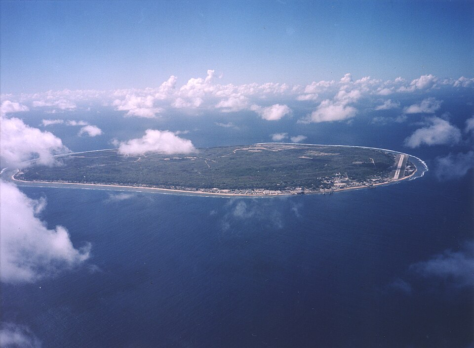
Nauru, ( ) is a island nation in the South Pacific. Its nearest neighbour is Kiribati, 300 kilometres (186 mi) east. Nauru is the smallest island nation, covering just 21 square kilometres, the smallest republic, and the only republican state without a capital. With 10,670 residents, it is the third least-populated country after Vatican City and Tuvalu.
Nauru is a phosphate rock island, and its main export since 1907 has been phosphate. English and Nauruan are the official languages. The president is David Adeang.
Geography
Nauru is a 21 square kilometres (8.1 sq mi) oval-shaped island in the southwestern Pacific Ocean, 42 kilometres (26 mi) south of the equator. The island is surrounded by a coral reef, which can be seen during low tide. Because of this, a harbor can not be built. Canals let small boats get to the island. An area of ground where plants can easily grow 150 to 300 metres (492 to 984 ft) wide lies inland from the beach.
Coral cliffs surround Nauru’s plateau (highland). The highest point, the Command Ridge, is 71 metres (230 ft) above sea level. The only fertile areas are near to the ocean, where coconut palms flourish. The land surrounding Buada Lagoon supports bananas, pineapples, vegetables, pandanus trees, and hardwoods such as the tomano tree.
Nauru was one of three great phosphate rock (bird droppings) islands in the Pacific Ocean (the others were Banaba (Ocean Island) in Kiribati and Makatea in French Polynesia). The phosphate reserves on Nauru are now almost used up. Phosphate mining in the plateau has left a bare area of land with limestone peaks up to 15 metres (49 ft) high. Mining has stripped and destroyed about 80 per cent of Nauru’s land, and has affected the surrounding Exclusive Economic Zone. About 40 per cent of marine life has been killed by mud and phosphate drainage.
There are only about 60 native vascular plant species on the island. Coconut farming, mining, and introduced species have damaged the island’s native vegetation. There are no native land mammals, but there are native insects, land crabs, and birds, including the Nauru Reed Warbler. The Polynesian rat, cats, dogs, pigs, and chickens have been introduced to Nauru from ships.
There are only a few fresh water sources on Nauru. Storage tanks collect rainwater, but the islanders usually have to rely on desalination plants at Nauru’s Utilities Agency.
The island’s biggest problems are climate change and rising sea levels. Nauru is the seventh most global warming threatened nation due to flooding. At least 80 per cent of the land of Nauru is well elevated, but this area will be uninhabitable until the phosphate mining improvement programme is started
Climate
Nauru’s climate is hot and very humid year-round because of how close it is to the equator and the ocean. Nauru is hit by monsoon rains between November and February, but does not usually have cyclones. How much rain there is every year is highly variable, and is influenced by the El Niño-Southern Oscillation. There have been many droughts in Nauru because of this. The temperature on Nauru ranges between 26 degrees Celsius (26 °F) and 35 degrees Celsius (35 °F) during the day, and between 22 degrees Celsius (22 °F) and 34 degrees Celsius (34 °F) at night.
Administrative divisions
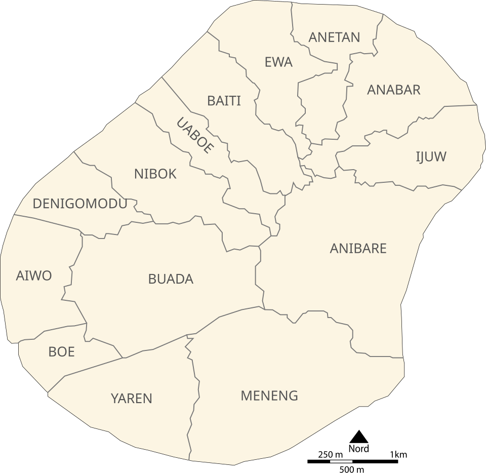
Nauru is divided into fourteen administrative districts.
Where this page comes from
The article above is adapted from “Nauru” on Simple English Wikipedia, by its contributors. We removed reference markers, navigation boxes and tables, expanded measurement templates into readable numbers, and kept the prose otherwise intact.
Both sources are published under CC BY-SA 4.0, so this page is published under the same licence. You may share and adapt it, including commercially, as long as you credit the original and keep the same licence.
Worksheets, answer keys and printable layouts elsewhere on K5Print are our own work and are not covered by this licence.