South America

South America is the continent to the south of North America. These two continents are separated by the Panama Canal. There are seven continents which make up the globe, South America being the 4th largest. South America includes 12 countries: Argentina, Bolivia, Brazil, Chile, Colombia, Ecuador, Guyana, Paraguay, Peru, Suriname, Uruguay, and Venezuela.
South America is attached to Central America at the boundary of Panama. Geographically all of Panama – including the part east of the Panama Canal is usually included in North America alone, among the countries of Central America.
Landscapes
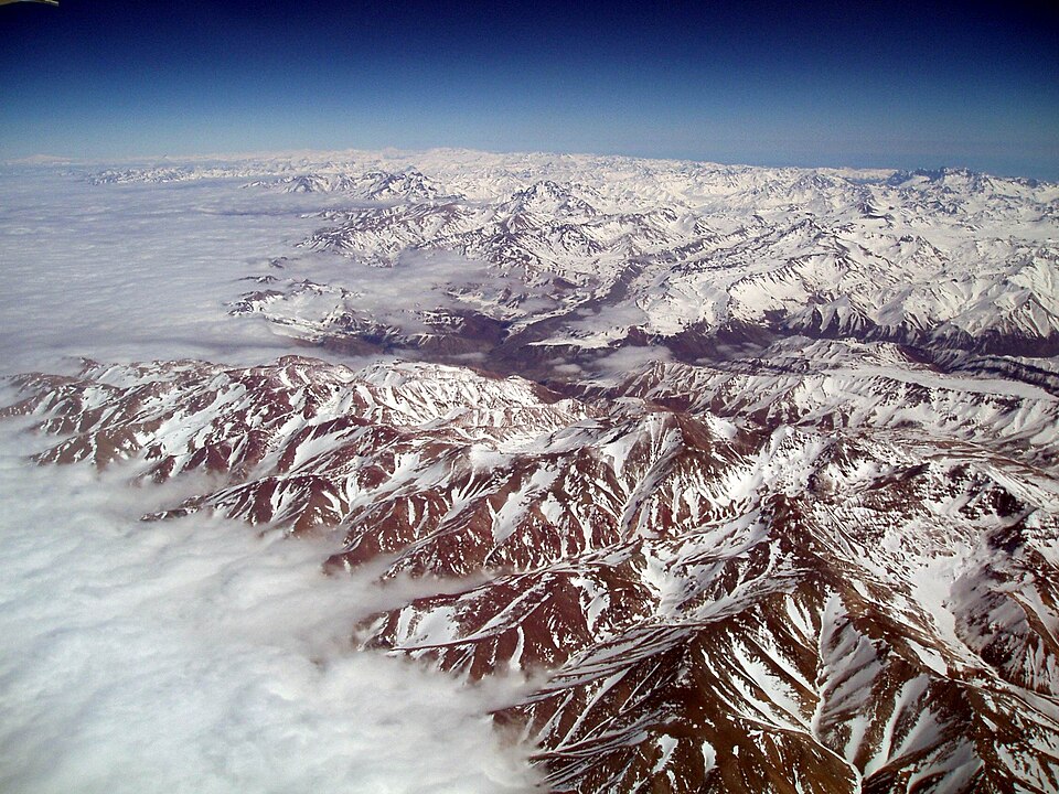
South America features an incredibly diverse landscape, dominated by the extensive Andes mountains along the west coast and vast eastern highlands. It holds extreme environments, including the driest desert (Atacama), the highest navigable lake (Titicaca), and the world’s largest river system.It is also home to the amazing Amazon forest.
History
South America’s history isn’t a dry list of dates; it is the collective memory of people who have constantly reinvented themselves. It’s the pride of a modern weaver in the Andes using techniques passed down through a hundred generations, and the echoes of heavy footsteps in colonial plazas where freedom was finally won. It carries the weight of ancestors who survived the arrival of outsiders and the resilience of those who were brought across the ocean in chains, only to weave their music and soul into the very fabric of the continent. Every town square tells a story of survival, from the quiet dignity of indigenous traditions that refused to disappear to the modern fire of students and workers marching for a better future. It is a story of scars, yes, but also of an incredible, stubborn joy that celebrates how far they have come together.
Geography
South America’s geography isn’t just a map of extremes; it is the physical heartbeat that shapes how people live every day. Imagine waking up in a village tucked into the jagged folds of the Andes, where the thin, crisp air dictates the slow pace of life and the hearty crops people can grow. To the east, life follows the pulse of the Amazon, where the river serves as the primary highway and the dense green canopy provides both a home and a livelihood. From the vibrant coastal cities where the Atlantic breeze carries the smell of salt and street food, to the quiet, windswept ranches of Patagonia where survival depends on grit and thick wool, the land is more than just scenery. It is a demanding but beautiful partner that influences the music, the food, and the resilient spirit of everyone who calls it home.
Natural resources
The soil in Argentina’s Pampas is among the best in the world. Brazil’s soil is very good for growing coffee. A great number of minerals have been found. Few, however, have been mined. Among those that were mined are iron, manganese, gold, and gemstones. The tropical forests are rich in valuable trees, like mahogany, ebony, and rubber. Oil is also a resource in some places.
Wildlife
South America is home to a large variety of animal life. These include animals such as jaguars, macaws, monkeys, anacondas, llamas, piranhas, toucans, rheas, tapirs, cougars, condors and chinchillas.
Tourist attractions
The most popular attractions are:
- Machu Picchu, a historic site in Peru which is a city made of stone and has an over 26 mile marathon.
- The Iguazu Falls, a waterfall on the border between Argentina and Brazil
- The Angel Falls, the world’s tallest waterfall, in Venezuela
- Rio de Janeiro in Brazil is a huge city, famous for its carnival, beaches (Copacabana and Ipanema), and 38m statue of Jesus Christ.
- The Patagonia region in Argentina and Chile
The Amazon rain forest
The amazon rain forest is a moist grassy land where many wild animals live and contains the amazon river which is the 2nd longest river in the world and has the largest volume of water. The world’s longest river is the Nile in Africa. The forest is known as a rain forest as it rains very often but due to the dense surroundings not every droplet reaches the bottom. The Amazon is shared by eight countries (Brazil, Bolivia, Peru, Ecuador, Colombia, Venezuela, Guyana and Suriname) and stretches for 6.7 million kilometers 2 . In the amazon rain forest, hundreds of thousands of trees have been cut down for wood and paper, meaning that the forest is endangered. Unlike the Boreial forest in Canada the trees are not getting replanted.
Written for younger readers
South America, in simpler words
This version comes from Wikijunior, a set of books written for children aged 8 to 11. It is shorter and uses plainer language than the article above.
From Wikijunior: South America
Part of Wikijunior South America project
Welcome to South America, the fourth largest continent on Earth. South America has 14 different countries in it and over 355 million people! The South Americans are famous for their parties, their music, their dances, and their food. The two major languages spoken in South America are Portuguese and Spanish, although French, English and Dutch are also spoken, as well as a variety of indigenous languages. If there are any words in this book you don’t understand you can look them up in the glossary.
To the north of South America lies the Caribbean and Central America, to the east lies the Atlantic Ocean, and past that Africa, to the south lies the coldest continent, Antarctica, and to the west lies the Pacific ocean, and past that Australia, Oceania, and Asia.
- English: Falkland Islands,
- Spanish: , , , , , , , ,
- Portuguese: , (note: these islands speak a Portuguese creole)
- Dutch: ,
- French: (French Guiana)
- Quechua: , , , , ,
- Aimara: , , ,
- Guaraní: , , ,
es:Wikichicos/América del Sur/América del Sur it:Wikijunior Sudamerica/Sudamerica
Where this page comes from
The article above is adapted from “South America” on Simple English Wikipedia, by its contributors. We removed reference markers, navigation boxes and tables, expanded measurement templates into readable numbers, and kept the prose otherwise intact. The simpler version is adapted from Wikijunior on Wikibooks.
Both sources are published under CC BY-SA 4.0, so this page is published under the same licence. You may share and adapt it, including commercially, as long as you credit the original and keep the same licence.
Worksheets, answer keys and printable layouts elsewhere on K5Print are our own work and are not covered by this licence.